Honoring the Best of Consulting Engineering since 1989.
Owner: Ministry of Transportation and Transit | Summerland, BC
About the Project
On August 28, 2023, a significant rockfall event occurred on Highway 97 between Summerland and Peachland, covering three out of the four travel lanes with approximately 3,000 cubic meters of rock. Upon investigation, geotechnical engineers discovered tension cracks above the rockfall source area, suggesting a larger slide could occur with an estimated total affected area to potentially be around 150,000 cubic meters.
These tension cracks were found upslope of a previous rockslide from the Fall of 2008, with new cracks extending beyond and behind the 2008 slide area. To address this, engineers installed a 22-meter-high gravel buttress at the base of the slide, successfully halting movements at the toe. However, upslope movements continued.
Stantec’s Geomatics team was engaged to develop a monitoring program that could accurately capture millimeter-scale movement in the slide area and set specific movement parameters that would trigger notifications and escalations for work stoppages and necessary road closures.
Stantec implemented a 24/7 monitoring system with millimeter accuracy to track the slightest movements in the rock bluff. This system provided a reliable reporting network to capture and analyze trends and reliable results to the geotechnical engineers. This monitoring system promotes the safety of construction crews on site and protecting the traveling public by delivering unparalleled results.
Approach
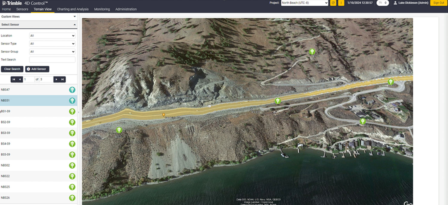
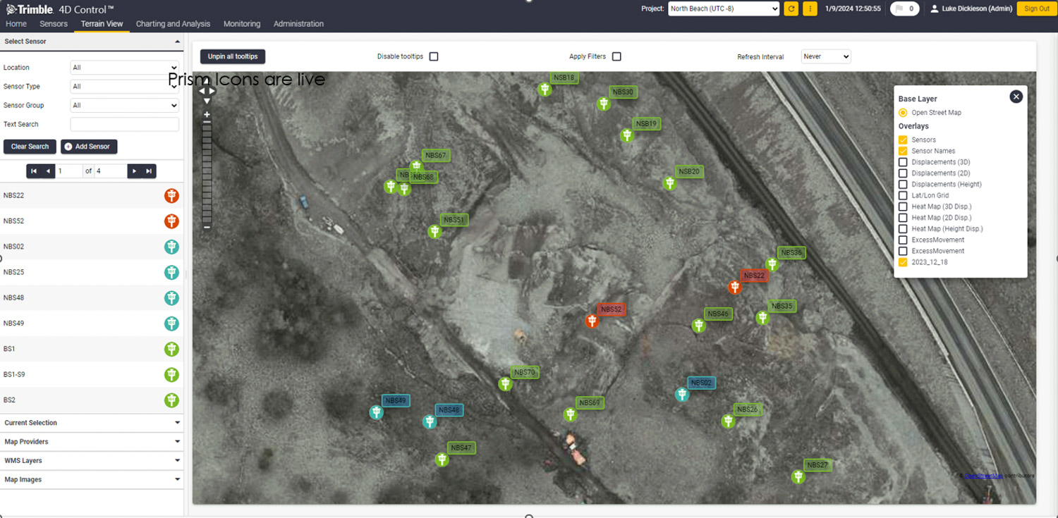
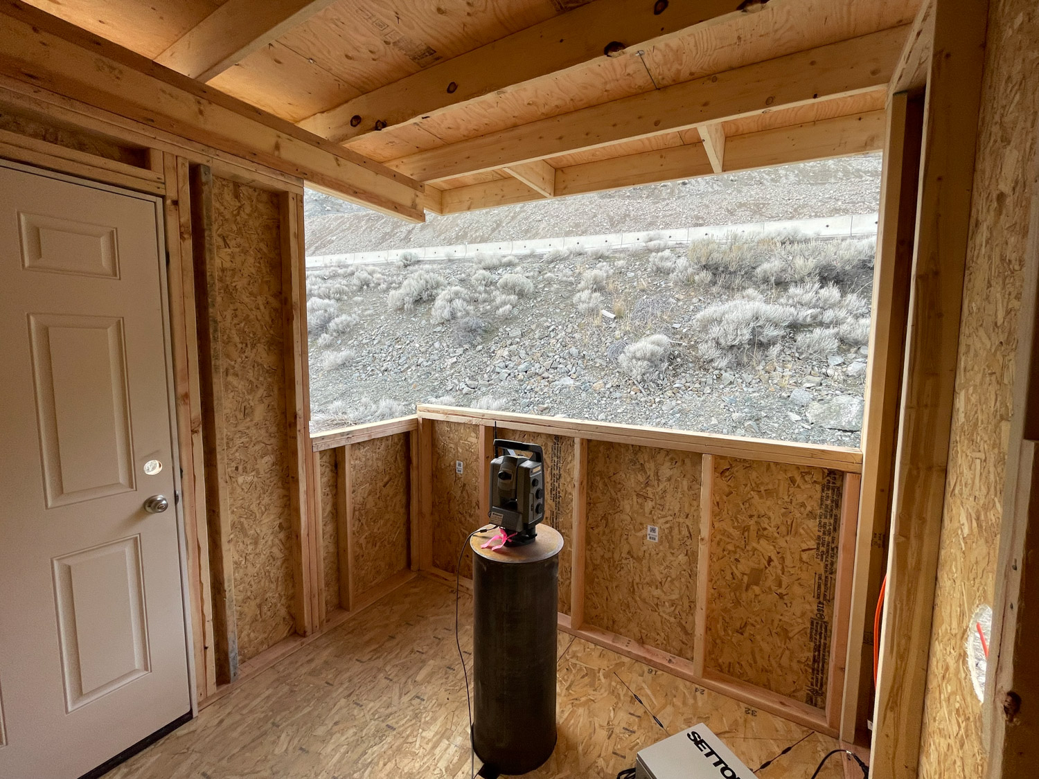
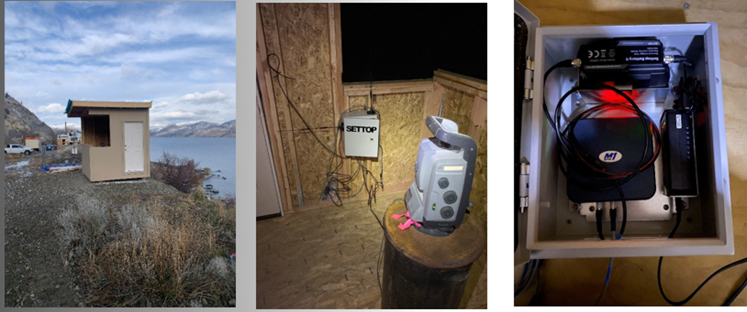
Before the Ministry could reopen the road and continue stabilizing the slope, Stantec was engaged to develop a monitoring program that could provide data, capture millimeter-scale movement, and set parameters that would trigger notifications to stop work. Choosing stable locations for backsights and monitoring was challenging due to a steep bank leading to Lake Okanagan on one side, and Hwy 97 and the failure zone on the other. Fortunately, a stable strip of Hwy was identified. Six 12-inch steel piles were drilled into the ground until refusal was set, with one pile for the 1” high precision robotic S8 total station and five piles for back sight prisms. 35 prisms were strategically placed on the sliding rock bluff and monitoring began, with multiple measurements being completed every hour and the results being manually uploaded into a spreadsheet and shared.
Due to the potential length stabilization of the bluff and the high manual monitoring cost, Stantec researched more efficient solutions to reduce onsite manpower and increase reporting confidence. The result was a Trimble T4D—a 24/7 remote cloud-based monitoring and reporting system. With client approval, Stantec purchased T4D along with a high-precision (0.5-second) Trimble S9 total station. The T4D system took over monitoring the prisms every half hour, comparing results, and checking for allowable movement tolerances. Scheduled reports with results and alerts were sent via email if tolerances were breached.
Results
Stantec provided a state-of-the-art, 24/7 remotely managed monitoring system with millimeter-level accuracy. This system not only tracks the slightest movements in the rock bluff but also provides a reliable reporting network to capture and analyze trends. This monitoring system promoted the safety of both construction crews on site and the traveling public, delivering unparalleled results and peace of mind.
Service(s) Provided
Survey
RPAS
Rock slope stability monitoring
Go back to projects in
View other projects from
Proudly presented by
Stay in touch with us
Subscribe to our mailing list!
Organization
Connect