Honoring the Best of Consulting Engineering since 1989.
Owner: City of Vancouver | Vancouver, BC
About the Project
The City of Vancouver required LiDAR data covering the entire land surface within the City of Vancouver, the University of British Columbia, and the University Endowment Lands. Extending beyond mere data processing, the project involved the classification of geographical features needed for diverse applications, from updating topographic maps to assessing natural hazards – including floods, landslides, and wildfires.
Initiated in 2022, McElhanney successfully executed the meticulous data acquisition process for the City of Vancouver, culminating in comprehensive processing during 2023. The complexity of the terrain and resulting LiDAR data point cloud made extracting various features, such as buildings and trees, challenging. Traditionally, data extraction and classifications are done manually, resulting in labor-intensive processes, increased costs, and higher time commitments. Recognizing advancements in artificial intelligence (AI), our team incorporated its ability to perform tasks normally requiring human intelligence into our workflow.
McElhanney developed an in-house AI model that underwent rigorous internal fine-tuning and training by our geospatial experts to adapt to the City’s unique intricacies. By strategically integrating AI into our processes, our team tackled the terrain challenges while simultaneously increasing the efficiency and accuracy of our results. This is the first AI LiDAR project of its kind to be deployed on such a vast scope equating to 134 km² of diverse terrain within Canada.
Approach
To meet the City of Vancouver’s needs, McElhanney executed an advanced aerial LiDAR data capture through the following phases.
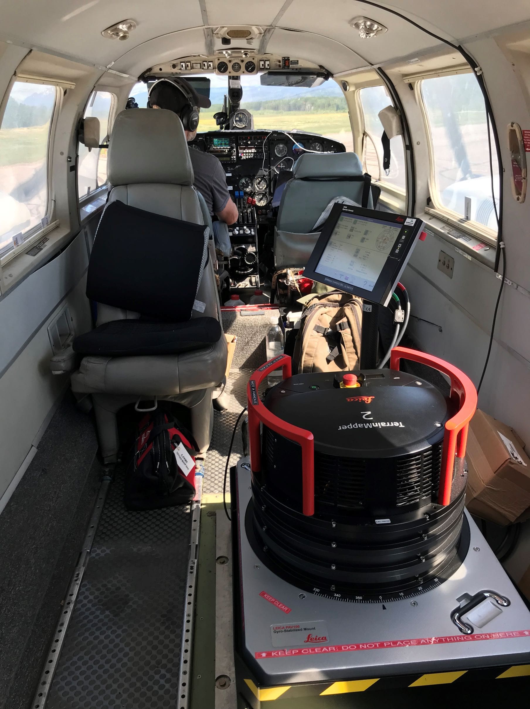
Phase One – Flight Plan & Data Acquisition: To meet the project requirements and collect optimal point density, McElhanney designed a flight pattern that would optimize data point collection via an aerial sensor (Terrain Mapper 2) from an operational range of 1,500m above ground.
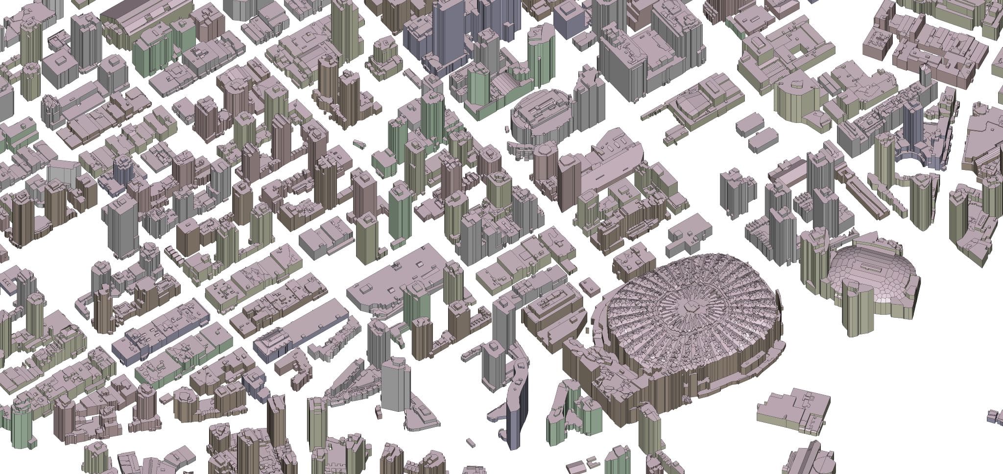
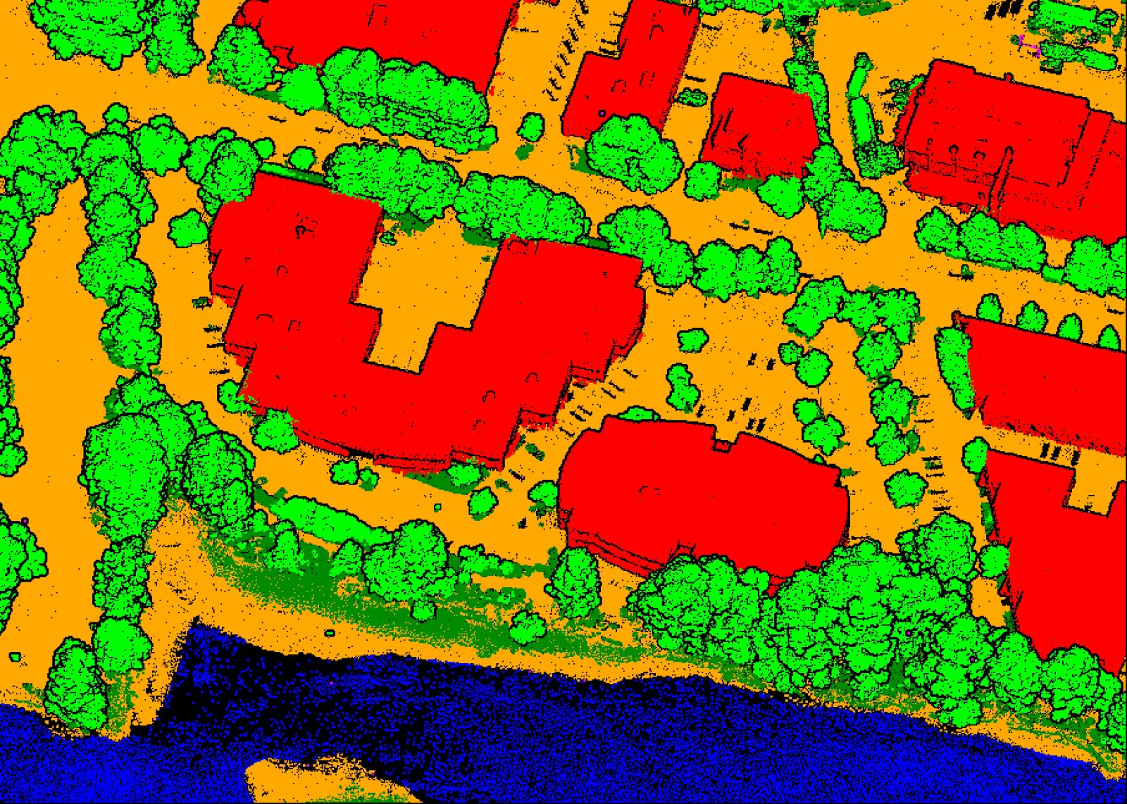
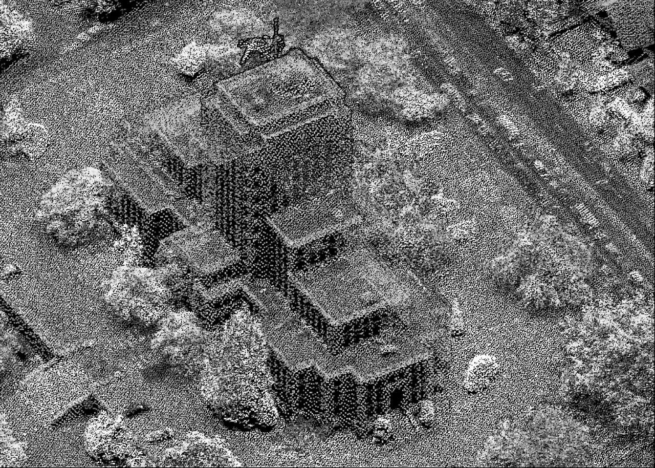
Phase Two – Data Processing: Crucial for achieving centimeter-level accuracy, data-processing involved utilizing a large server to process data for detailed laser data extraction. The resulting data point cloud exhibited a mean density of 50 points/m² surpassing the industry standard of 10-15 points/m², equating to larger levels of detail for buildings, trees, and other features.
Phase Three – Data Classification: The project’s innovation lies in its 3D feature extraction using AI. Traditional methods involve a multi-step routine, often requiring manual digitization and classification, making the process labor-intensive. McElhanney’s approach employed an AI model trained and tested on a dataset from Vancouver and Burnaby, BC, Canada.
To enhance the model’s robustness, our team optimized it for 3D city modeling. As a result, the model effectively differentiated buildings from other points. Further fine-tuning of the model allowed for data point classifications for buildings, ground, water, and vegetation.
Results
McElhanney’s AI model demonstrated superior performance compared to traditional methods, marking a shift in project approach. The utilization of AI for data classification at this scale resulted in substantial savings in labor costs and significantly expedited project delivery.
The project’s success lies not only in its technological innovation but also in its adaptive approach, showcasing the potential for AI-driven 3D feature extraction in diverse geographic and project-specific scenarios.
Service(s) Provided
Provision of aerial LiDAR
Classification of point clouds
Go back to projects in
View other projects from
Proudly presented by
Stay in touch with us
Subscribe to our mailing list!
Organization
Connect