Honoring the Best of Consulting Engineering since 1989.
2023 Award of Excellence
About the Project
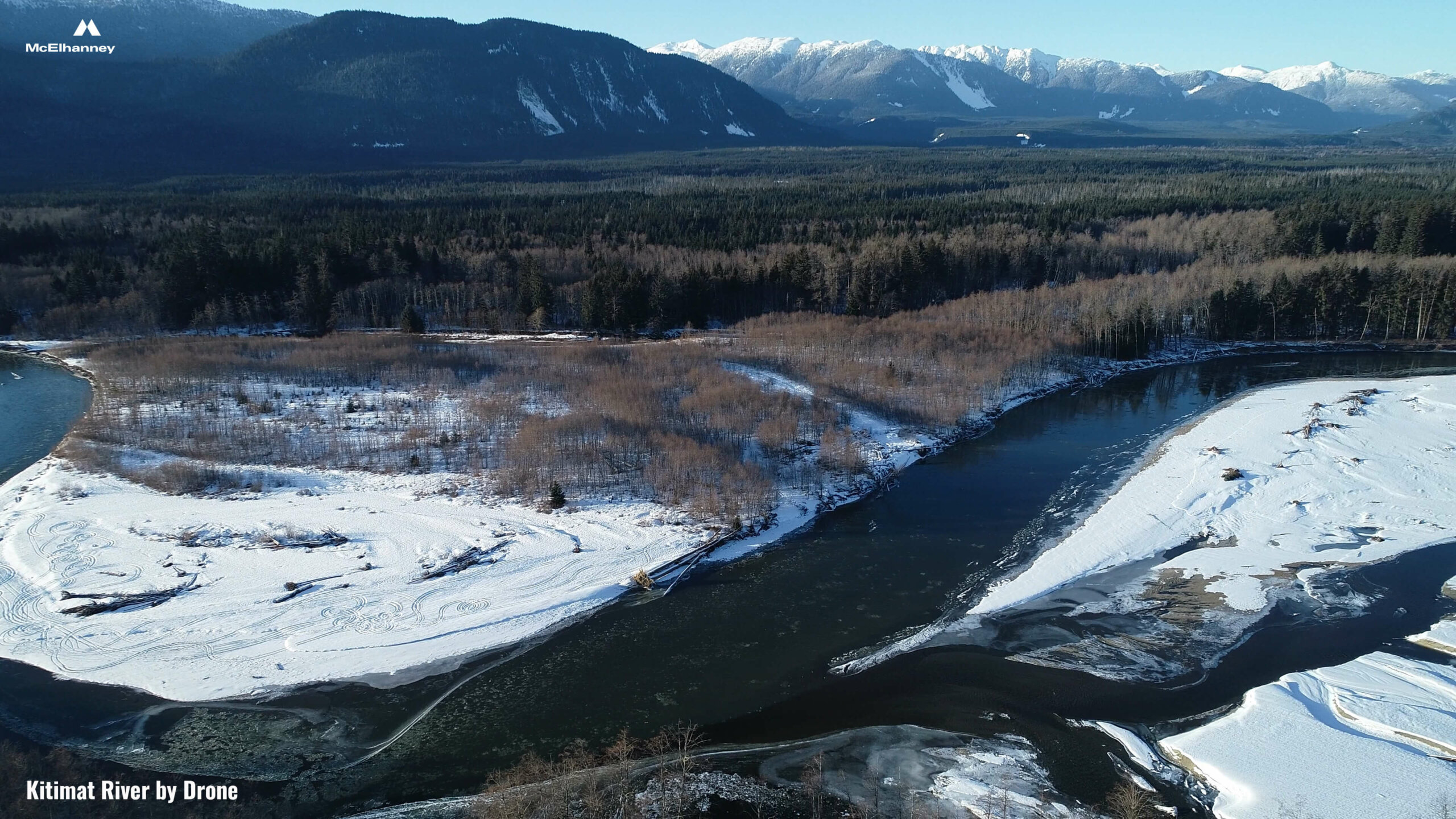
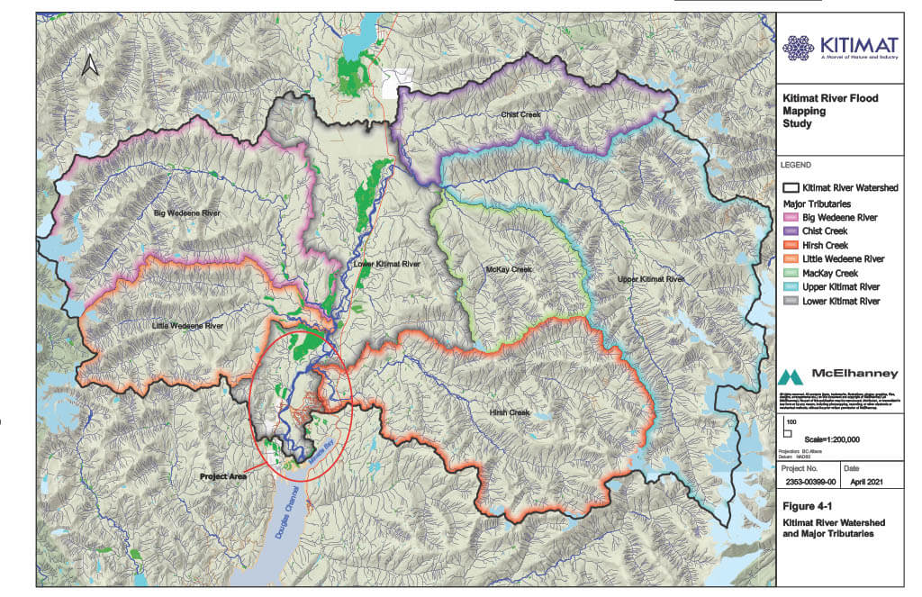
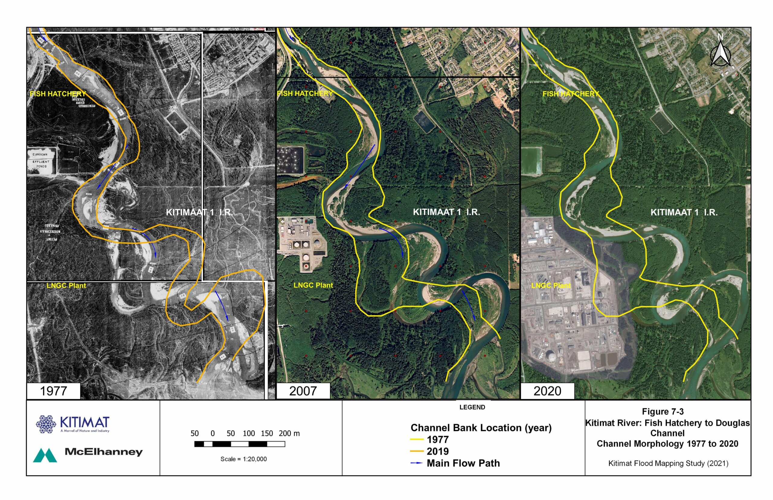
This project began as other flood mapping projects do; the existing flood maps were from 1982 and the District of Kitimat (the District) knew they required an update. The 1982 maps did not communicate how the Kitimat River changed over the last 40 years, and the community had suffered multiple flood events with media-worthy impacts.
Flood mapping projects can produce results that collect dust on a shelf. But when flood mapping is viewed as the first step in a community’s journey to sustainable flood risk management, the value of the project changes. When the District’s RFP for flood mapping came out, McElhanney saw an opportunity; the District could further their flood risk management strategy in several ways within the scope of a single project.
McElhanney recommended the District redefine their expectations to include a flood risk assessment and risk mitigation option review. The new scope would be twofold: produce insightful mapping and generate real-world risk mitigation options. An eye was kept on key sustainability considerations each step of the way.
If ever there was an approach that would ensure against dust collection, this was it.
Team members managed the project who live in Kitimat. They knew how the river reacted under different conditions and understood the impact of flooding on the community and critical infrastructure. Their local knowledge informed the flood mapping process and paved the way for a flood risk assessment and risk mitigation option review that was equitable to each project partner.
The journey to sustainable flood risk management does not involve a single project. Instead, it calls for a staged plan that identifies needs and responds to them in a strategic and thought-out way. The Kitimat Flood Risk Management Strategy is a community and consultant collaboration model that turns mapping and data analysis into real-world strategies spanning structural and non-structural solutions.
Approach
Flood mapping began with an information collection and review process, including a bathymetric survey of the Kitimat River and Minette Bay and Digital Terrain Model compilation. During the subsequent analysis and modelling phase, McElhanney developed fluvial hydraulic model; the consequence of high tide levels combined with high river levels required specific evaluation. We produced flood inundation maps and flood hazard maps based on the resulting data.
Next, our team moved to the delivery of the flood risk assessment. We reviewed historical flooding and considered flood hazard impacts across five categories from Canada’s National Disaster Mitigation Program. We identified priority hazards that required the application of risk mitigation. With the risk assessment complete, we produced a third and final set of flood maps, this time addressing risk. These flood risk maps laid the foundation for the risk mitigation options process.
Determining risk mitigation options was a two-stage process, beginning with option recommendation and review followed by preferred option identification. We hosted seven District departments at a mitigation options workshop and evaluated option recommendations against a ten-factor matrix.
Finally, we delivered two versions of final reporting covering the three map types, risk assessment, and mitigation option review: one for technical consideration and one for public engagement.
Results
Today, two of the District’s risk mitigation options are underway. First, a flood awareness campaign was launched, featuring tools such as infographics, an FAQ webpage, and public open house events. Second, planning support began with a specialized report and will continue into bylaw and zoning review and amendment recommendations.
McElhanney was engaged in managing the delivery of these risk mitigation options as the District continues their journey to sustainable flood risk management.
Service(s) Provided
– Produced flood mapping
– Quantified the District of Kitimat’s flood hazard impacts and completed a flood risk assessment
– Detailed risk mitigation option review
– Delivered two versions of final reporting that covered the mapping, risk assessment and mitigation option review; one for technical consideration, and one for use in public engagement
Project Team (Consultants)
Great Pacific Consulting
Go back to projects in
View other projects from

Proudly presented by
Stay in touch with us
Subscribe to our mailing list!
Organization
Connect